Walks and Outdoor Adventures
Start Your Next Adventure
Dolgellau is one of the best bases in southern Snowdonia for walking, cycling and outdoor adventures. From gentle riverside strolls to mountain routes, forest trails and traffic-free cycling, there is plenty to explore without needing to spend hours in the car.
Fro Awel is especially well placed if you want a holiday built around fresh air, big views and active days out. You can walk from the town, cycle towards the Mawddach Estuary, head into the forests at Coed y Brenin, or take on one of Wales’ most iconic mountains at Cadair Idris. Here’s a list of our local favourites.
Cadair Idris
If you’re staying in Dolgellau for a walking holiday, Cadair Idris is likely to be high on your list. It is one of the great mountains of Wales, rising above southern Snowdonia with views over Dolgellau, the Mawddach Estuary, Barmouth, Cardigan Bay and, on a clear day, deep into the Eryri landscape.
Fro Awel is especially well placed for Cadair Idris because the Pony Path starts from the Dolgellau side of the mountain at Tŷ Nant, which is only a short drive from the cottage. Strong walkers can also walk to the start from Meyrick Street, making it possible to do the mountain without moving the car.
-
From Fro Awel on Meyrick Street, the nearest main starting point is Tŷ Nant car park, the start of the Pony Path. By car, it is only a short drive out of Dolgellau towards the Cadair Idris side of town. On foot, allow roughly 50–70 minutes to walk from the cottage to Tŷ Nant, depending on pace, weather and how much gear you are carrying.
If you walk from Fro Awel all the way to the summit and back, allow for a much longer day. The official Pony Path route from Tŷ Nant alone is around 10 km / 6 miles and is usually given as around 5 hours there and back. Adding the walk from Dolgellau to Tŷ Nant makes it a proper full-day outing, so plan accordingly. Visit Wales describes the Pony Path as starting from the Dolgellau side of Cader Idris and gives the route as 10 km / 6 miles, allowing around 5 hours return from Tŷ Nant.
-
The three main Cadair Idris parking options are:
Tŷ Nant car park
Best for the Pony Path and the most convenient option from Dolgellau.Dôl Idris / Minffordd car park
Best for the Minffordd Path, which starts on the southern side of the mountain.Llanfihangel y Pennant car park
Best for the longer, quieter Llanfihangel y Pennant Path.Car parks are operated by Eryri National Park and charge for parking, with card payments accepted; Llanfihangel y Pennant is free but very small (opposite the Church). Car parks can fill up at busy times, so getting there early is sensible.
-
Cadair Idris is very popular in good weather, especially during school holidays, bank holidays and summer weekends. If you are walking the Pony Path or Minffordd Path, it is worth starting early to get parked, avoid the busiest part of the day and give yourself enough time on the mountain.
The weather can also change quickly. Even if Dolgellau is warm and still, the summit can be windy, wet or cloud-covered. Treat Cadair Idris as a proper mountain walk, not a casual stroll.
-
This is usually the best route if you are staying at Fro Awel and want the most convenient start from Dolgellau.
The Pony Path begins at Tŷ Nant and climbs the northern slopes of Cadair Idris. It is still a hard mountain walk, but it is generally the most straightforward of the main routes and gives wonderful views over the Mawddach Estuary towards Barmouth. Eryri National Park lists the Pony Path as a hard/strenuous route, 10 km long, with 727 metres of ascent and an estimated duration of 5 hours.
The early part climbs through woodland and open ground before reaching more exposed mountain terrain. Higher up, the route follows the ridge above Llyn y Gadair before the final climb to Penygadair, the summit of Cadair Idris. The Pony Path is a steepish climb with steps in places, giving views over the Mawddach Estuary towards Barmouth and then inland towards Bala and Llyn y Gadair.
Best for: guests staying in Dolgellau, classic views, the most convenient Cadair Idris route from Fro Awel.
Difficulty: hard/strenuous, but generally the most approachable of the main routes.
-
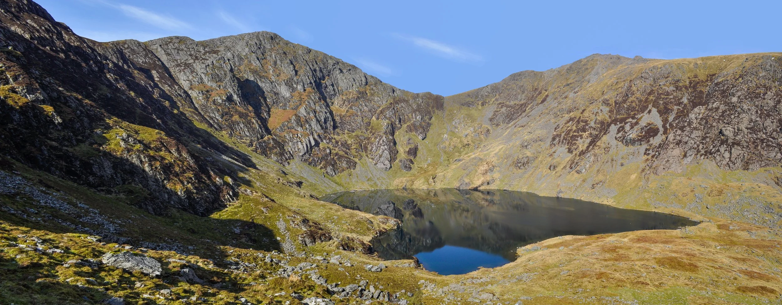
The Minffordd Path starts from Dôl Idris on the southern side of Cadair Idris. It is shorter than some routes, but it climbs hard and fast, making it one of the steepest and most dramatic ways up the mountain.
This route takes you through Cwm Cau and past Llyn Cau (pictured), the famous mountain lake beneath the cliffs of Cadair Idris. The scenery is spectacular, but the climb is demanding. Eryri National Park describes the Minffordd Path as one of the shortest routes up Cader Idris but with the most significant ascent. It is graded hard/strenuous, 9 km long, with 788 metres of ascent and an estimated duration of 6 hours.
Best for: dramatic scenery, Llyn Cau, experienced walkers wanting a steeper mountain day.
Difficulty: hard/strenuous and steeper than the Pony Path.
-
This is the longest and usually quietest of the three main routes. It starts from Llanfihangel y Pennant in the Dysynni Valley and approaches Cadair Idris more gradually before eventually joining the Pony Path higher up.
Eryri National Park describes it as the easiest path up Cader Idris in terms of gradient, but also the longest at 16 km, with 867 metres of ascent and an estimated duration of 7 hours. It is still graded hard/strenuous and requires good fitness and navigation skills.
This is a good choice if you want a quieter walk and don’t mind a longer day. It is less convenient from Dolgellau than the Pony Path, but it gives a very different feel to the mountain.
Best for: quieter walking, longer days, experienced walkers who want a less busy route.
Difficulty: long, hard/strenuous, but generally more gradual until it joins the higher route.
-
Cadair Idris is not just a walking mountain. There is also excellent climbing and scrambling, particularly around Cyfrwy and Cwm Cau.
For climbers, the classic area is the Cyfrwy Arete on the north side, with further steep buttresses around Cwm Cau on the south-east side. UKClimbing lists Cadair Idris / Penygadair as having 160 climbs and notes the classic Cyfrwy Arete on the north side, as well as isolated steep buttresses around Cwm Cau.
For scramblers, two of the main routes often mentioned are Tapia Llwydion and Cyfrwy Arete. UK Scrambles describes Tapia Llwydion as a south-side scramble from Cwm Cau, with routes ranging around Grade 2 with optional harder sections, and lists Cyfrwy Arete as another main scrambling route on Cadair Idris.
This is only for people with the right experience and equipment. The mountain has steep ground, loose rock, sudden weather changes and serious exposure in places.
-
Cadair Idris sits close to the famous Mach Loop, the low-flying military aircraft training area used through parts of mid Wales. If you are lucky, you may see fast jets passing through the valleys while you are out on the mountain or exploring nearby viewpoints.
It is never guaranteed, but it can be an unforgettable sight if you happen to catch one.
-
If you want the most practical Cadair Idris day from the cottage, choose the Pony Path from Tŷ Nant. It is the nearest main route from Dolgellau, the easiest to reach from Fro Awel and gives you the classic mountain experience without needing to drive around to the southern side.
If you want the most dramatic scenery, choose Minffordd for Llyn Cau and the steeper climb.
If you want the quietest and longest day, choose Llanfihangel y Pennant.
Whichever route you choose, start early, check the weather, take proper footwear and waterproofs, and allow more time than you think you’ll need. Cadair Idris is beautiful, but it is a serious mountain.
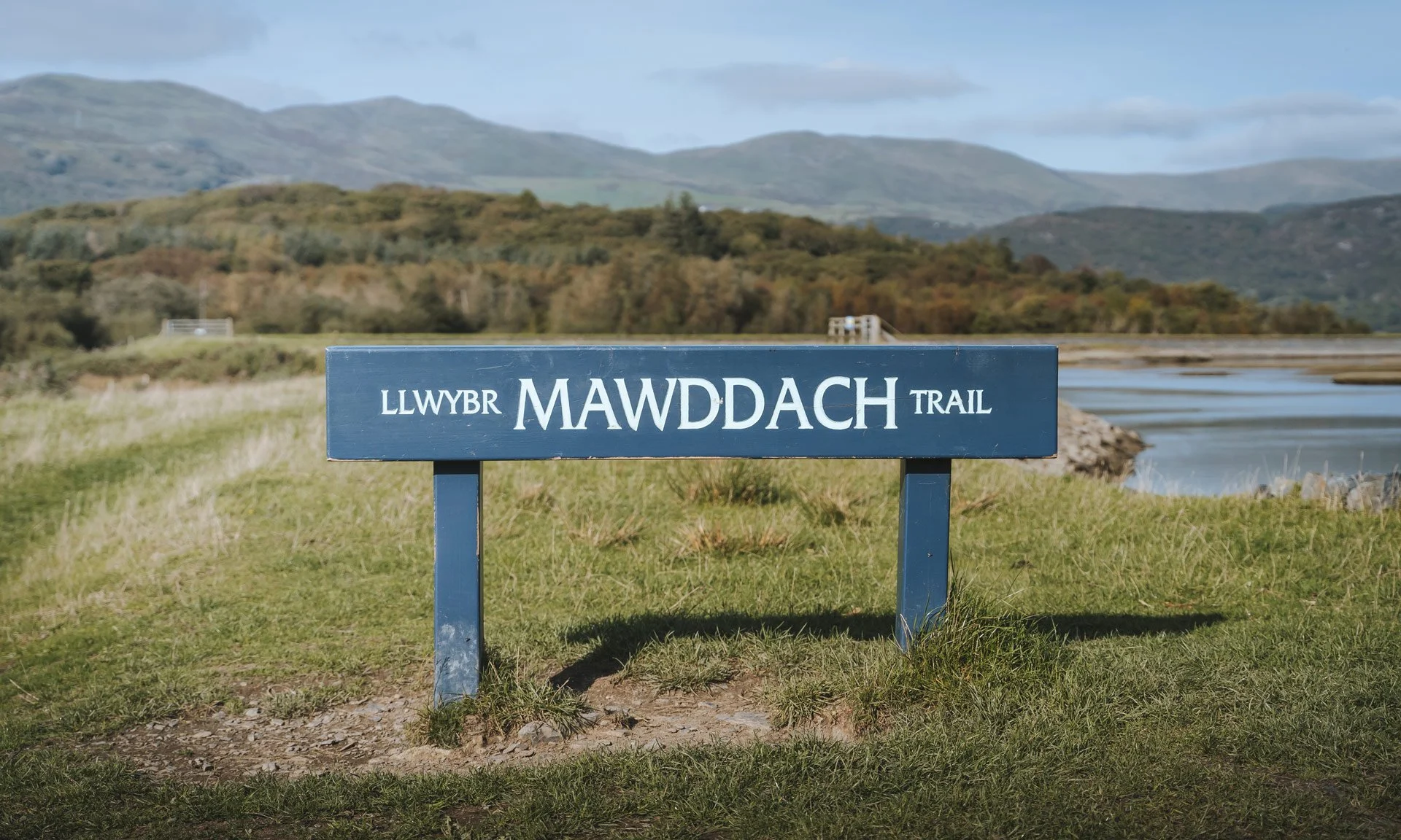
Mawddach Trail
The Mawddach Trail is one of the easiest outdoor wins from Fro Awel. It is beautiful, mostly flat, family-friendly and starts close enough to the cottage that you can leave the car behind. The trail follows the old railway line along the Mawddach Estuary from Dolgellau towards Barmouth, with mountain views on one side and wide estuary scenery on the other.
It is ideal for walking, cycling, children, pushchairs and mixed-ability groups. Eryri National Park describes the Mawddach Trail as one of the most flexible and accessible trails in the National Park, stretching between Dolgellau and Barmouth along the southern shore of the estuary. The National Park also categorises it as an Easy – Access for All route, with predominantly flat, even terrain and no steps or steep sections.
-
From Fro Awel on Meyrick Street, you can walk or cycle down through Dolgellau to join the trail at Y Marian / Marian Mawr car park, which is the main Dolgellau starting point for the Mawddach Trail. The official listed parking postcode for this access point is LL40 1DL.
From the cottage, allow roughly 5-10 minutes on foot to reach the trail start, depending on pace. By bike, it is only a couple of minutes. This makes it one of the easiest routes to enjoy directly from Fro Awel without needing to drive anywhere first.
The full trail from Dolgellau to Barmouth is around 9 to 9.5 miles each way, depending on the source and exact start/end point. Walk Wheel Cycle Trust lists the Dolgellau to Barmouth route as 8.9 miles / 14.3 km, while other local and tourism sources describe it as around 9.5 miles / 15 km.
-
The Mawddach Trail is one of the best family cycling routes in the area because it avoids most road traffic. Walk Wheel Cycle Trust lists the route as 97.2% traffic-free, with the main caution being a short 300-metre section between Barmouth railway bridge and Barmouth town centre on the A496.
From memory, if you are starting from Dolgellau and heading towards Penmaenpool or further along the estuary, there is just one road to cross. For families, that makes a big difference. You can settle into the ride, let children enjoy the scenery and avoid the stress of constantly managing traffic.
A lovely shorter option with younger children is to ride from Fro Awel down to the trail, follow it towards Penmaenpool, and stop at The George III for lunch by the estuary. We used to do this as a shorter family ride, and our then five-year-old managed it well. It gives you the feeling of a proper outing without committing everyone to the full ride to Barmouth and back.
-
For families or anyone wanting a gentler outing, the ride from Dolgellau to Penmaenpool is the easiest recommendation.
Start at Fro Awel, join the Mawddach Trail at Y Marian, then follow the flat estuary route towards Penmaenpool. The George III sits by the estuary and makes a natural stopping point for lunch, drinks or a rest before heading back the same way.
This shorter ride gives you:
estuary views
a mostly flat route
very limited road exposure
a proper destination
the option to turn back whenever you need to
It is a good choice for children, occasional cyclists or anyone who wants a relaxed ride rather than a full-day adventure. The pub is directly on the path at Penmaenpool, around 2.5 miles from Dolgellau.
Best for: families, younger children, relaxed cycling, lunch by the estuary and confidence-building rides.
-
If you want to make more of a day of it, continue along the trail all the way towards Morfa Mawddach and over Barmouth Bridge into Barmouth. This is the classic full route and one of the most scenic easy cycling days in southern Snowdonia.
The trail follows the former railway line beside the estuary, with views across to the Rhinogydd mountains, Cadair Idris behind you and Barmouth ahead. The trail forms part of Lôn Las Cymru / National Cycle Network Route 8 and follows the route of the old Barmouth to Ruabon railway line, which operated between 1869 and 1965.
The final stretch over Barmouth Bridge is one of the highlights, with wide views across the estuary mouth. Once you cross the bridge, take extra care on the short road section into Barmouth town centre.
For most casual cyclists, Dolgellau to Barmouth and back is a half-day to full-day ride depending on pace, stops and whether you have lunch in Barmouth.
Best for: easy cycling, big views, Barmouth Bridge, full family days out and traffic-free riding.
-
The Mawddach Trail is not just for bikes. It is also a very enjoyable walk, especially if you want something flatter than the mountain routes around Cadair Idris.
For a short walk, head from Dolgellau towards Penmaenpool and turn back when you feel ready. For a longer walk, continue along the estuary towards Morfa Mawddach and Barmouth. The whole trail is approx. 9.6-mile / 15 km and an easy leisure walk, suitable for all the family and involving no climbing.
If you only want to do the route one way, arrange a lift, taxi or check local bus options in advance. Otherwise, the simplest option is to turn around at a comfortable point and enjoy the same beautiful views on the way back.
Best for: flat walks, estuary views, birdwatching, photography and easier days outdoors.
-
The trail is mostly flat and easy to follow, but it is not all smooth tarmac. It is a mostly unsealed loose surface.
For cycling, a hybrid bike, mountain bike, gravel bike or e-bike is ideal. Children’s bikes are fine as long as they are comfortable on compacted trail surfaces. Road bikes with very narrow tyres are less suitable.
For walking, trainers are usually fine in dry weather, although comfortable walking shoes are better if it has been wet.
-
If you have children or want a gentle first ride, start with the Dolgellau to Penmaenpool section. It is scenic, manageable and gives you a natural reward at The George III before turning back.
If you want the full experience, continue to Barmouth Bridge and into Barmouth, but allow plenty of time and take care on the short road section once you leave the bridge.
For guests staying at Fro Awel, this is one of the easiest and most rewarding outdoor adventures in the area: no big climb, no long drive, and beautiful Snowdonia scenery almost straight from the front door.
Precipice Walk
The Precipice Walk is one of the best “big view for manageable effort” walks near Dolgellau. Despite the dramatic name, it is not a mountain climb like Cadair Idris. It is a relatively short circular walk high above the Mawddach Estuary, with superb views across the valley, towards the Rhinogydd mountains and back towards Cadair Idris.
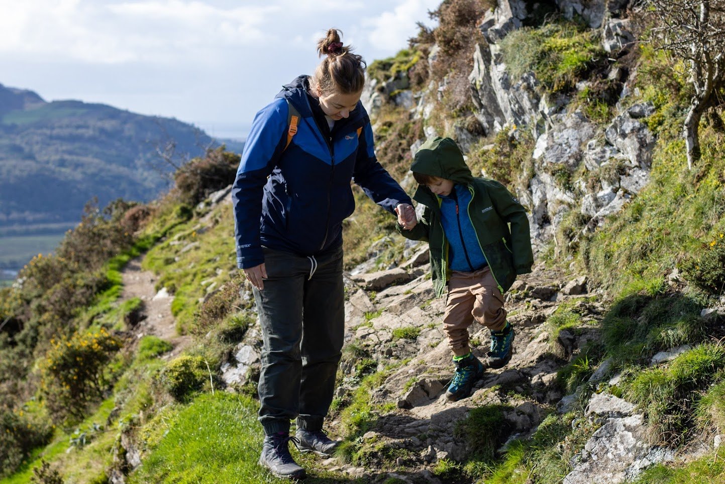
It is a brilliant choice if you want a scenic half-day walk without taking on a full mountain route. It is also a good option for families with sensible children, but there are narrow and uneven sections with steep drops, so younger children need close supervision.
The route is on private land belonging to the Nannau Estate. Public access has been allowed since 1890, provided walkers follow the route and observe the countryside code.
-
From Fro Awel on Meyrick Street, the usual starting point is the Precipice Walk car park, also known as Saith Groesffordd
By car, allow around 10–15 minutes from the cottage, depending on traffic and how carefully you take the narrow lanes. The car park is about 2.3 miles up the Dolgellau to Llanfachreth road, north of Dolgellau.
You can technically walk from Dolgellau to the start, but I would not present it as the main option for guests. The walk up to the car park is on country roads and lanes and it’s steep, so it adds a fair amount before you even begin the circular route. For most guests, especially families, it is much better to drive to the car park and save the walking for the route itself. -
Park at the Precipice Walk car park / Saith Groesffordd car park, near Llanfachreth.
Useful details:
Nearest postcode: LL40 2NG
Grid reference: SH 746 212 / SH 745 211
Parking: free
Facilities: public toilets are at the car park
Start/finish: circular route from the car park
The car park is not huge, and the walk is popular, so arrive earlier during weekends, school holidays and good-weather days.
-
The official Eryri National Park route gives the Precipice Walk as:
Route type: circular
Length: 5 km
Duration: around 2 hours
Difficulty: moderate
How busy: popular
Although the route stands around 800 ft above sea level, there is relatively little climbing and descending along the walk, as you ascend most of the way during the short drive to the car park. This makes it a good adventurous family option.
The exact distance depends on the route notes used and small variations from the car park but it’s around 3 miles. Allow 2 hours, or longer if you stop for photos, snacks or views.
-
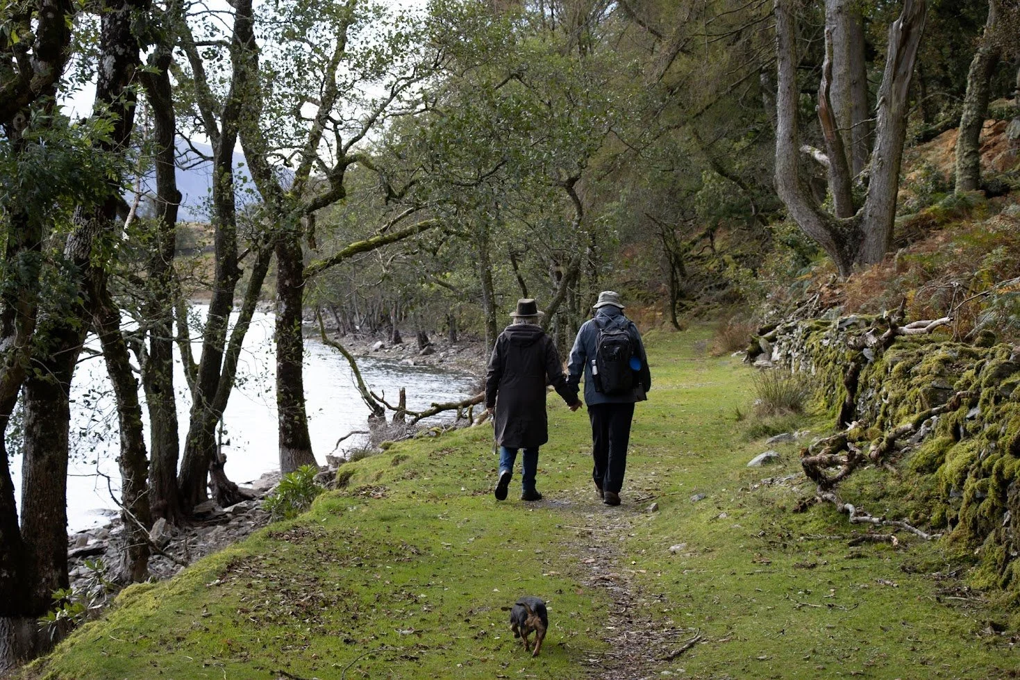
From the car park, the route heads towards Llyn Cynwch, a peaceful lake/reservoir (where I took this picture), before continuing around the slopes of Foel Cynwch and Foel Faner. The walk passes through a mix of woodland, lakeside paths, open ground and finally rewards you with high-level sections and far-reaching views.
The name “Precipice Walk” sounds intimidating, but much of the route is fairly steady. The drama comes from the position of the path high above the valley rather than from a difficult climb. That said, parts of the path are narrow, uneven and exposed, so it is not ideal for anyone with a strong fear of heights.
The route is relatively level in many places but narrow and uneven in parts, and not recommended for anyone with a bad fear of heights. On many ocassions we’ve followed the path clockwise, past the lake, until we can take the views in. Then you can turn back the way you came avoiding the narrower parts of the full circuit.
-
Yes, for many families — but with caution.
This is not a technical mountain route, and Eryri National Park specifically describes it as a great option for an adventurous family outing.
However, I would be clear with guests that:
the path is narrow in places
there are steep drops on some sections
children should be closely supervised
it is not suitable for running ahead
it is best avoided in very poor visibility or high winds
sensible footwear is needed
For younger children, I would suggest starting on the normal clockwise route with the lakeside section and only continuing after you’ve reached the main views if everyone is comfortable.
-
This is one of the reasons the Precipice Walk is so popular. For relatively little climbing, you get some of the finest views around Dolgellau.
Look out for:
the Mawddach Estuary
Cadair Idris
Coed y Brenin
the Rhinogydd mountains
Llyn Cynwch
Dolgellau and the surrounding valley
It is especially good on a clear day, but it also has atmosphere in softer weather when cloud hangs over the hills. For photos, allow extra time. A two-hour walk can easily become a slower half-day outing if you stop often.
-
The Precipice Walk is perfect when you want the feeling of a proper Snowdonia walk without committing to a full mountain day. Drive up from Fro Awel, park at Saith Groesffordd, and allow a couple of hours for the loop — longer if you want to stop for photos or take it slowly.
For families, start gently around Llyn Cynwch and judge from there. If everyone is confident, carry on around the full circuit. If not, the lake and early viewpoints still make it a lovely outing.
It is one of those walks that gives far more than the mileage suggests: short enough for a relaxed morning, but memorable enough to feel like a real part of your Snowdonia holiday.
Torrent Walk
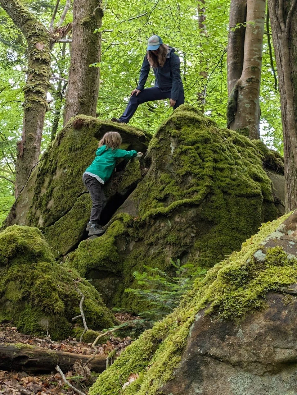
Torrent Walk is a brilliant short walk close to Dolgellau, and a good choice when you want something atmospheric without committing to a full mountain day. It follows the Afon Clywedog through a wooded ravine, with rushing water, small cascades, steep banks, bridges, and plenty of shade.
This is a very different walk from Cadair Idris or the Mawddach Trail. It is shorter, more enclosed and more woodland-based. It is ideal for a slower morning, a damp-weather wander, a family outing, or a leg-stretch before heading back into Dolgellau for coffee, cake or food.
-
From Fro Awel on Meyrick Street, Torrent Walk is very close. The usual starting point is from the lay-by on the B4416 Brithdir Road, just outside Dolgellau.
By car, allow around 5 minutes from the cottage. It is one of the quickest outdoor walks to reach from Fro Awel.
You can also walk from the cottage, but I would describe that as an optional extra rather than the main recommendation. The walk from Fro Awel to the start takes roughly 30–40 minutes each way, depending on pace and exact route, and involves roads rather than a dedicated traffic-free path. For most guests, especially families, it is easier to drive to the lay-by and save energy for the woodland walk itself.
-
The main parking is in two roadside lay-bys on the B4416 between Dolgellau and Brithdir, one on each side of the road.
Useful details:
Nearest postcode: LL40 2RH
Grid reference: SH 76105 18170
Parking: roadside lay-by parking
Start point: lay-by on B4416 Brithdir Road
Facilities: no major facilities at the start, so use toilets in Dolgellau before you go
The parking is easy to miss, and there are only limited spaces. If you are visiting on a sunny weekend, during school holidays or later in the day, it is worth arriving early or being prepared to come back another time.
-
Route Length, Time and Difficulty
The official Eryri National Park route gives Torrent Walk as:
Route type: circular
Distance: 4 km / 2.6 miles
Duration: around 1 hour
Difficulty: moderate
The National Park PDF lists the route as 4 km / 2.6 miles, circular, taking around 1 hour, and graded moderate.
We’d agree with this but we usually stop at spots and enjoy the tranquility, so we take around 1.5 to 2hrs to enjoy our walk here. -
Torrent Walk is a wooded gorge walk rather than a wide, open-view route. The path follows the river as it drops through the ravine, with sections where you can hear the water rushing below you before you see it.
There are small waterfalls, rocky stream sections, bridges and mossy woodland, making it especially good after rain or in autumn when the trees are changing colour. The walk also passes old industrial remains, including traces of former mills and ironworking activity.
The path is not especially long, but it is not completely flat. Expect uneven ground, roots, slopes, steps and muddy sections after rain. It feels more adventurous than the distance suggests, which is part of its appeal.
-
Yes, Torrent Walk can be a good family walk, especially for children who enjoy woods, water, bridges and a bit of adventure. It is much shorter than Cadair Idris and more varied than a simple flat path.
However, I would not describe it as pushchair-friendly or suitable for very young children to run ahead. There are uneven sections, drops down towards the river in places, and the path can be slippery after rain.
For families, I would suggest:
keep younger children close
wear proper shoes or boots
avoid rushing the route
take care near bridges, banks and wet rocks
avoid it in very icy or stormy conditions
It is a lovely option when you want a “proper little adventure” without a long day out.
-
Torrent Walk is one of the easiest short walks to fit into a stay at Fro Awel. Drive the few minutes to the B4416 lay-by, follow the circular route through the ravine, then head back into Dolgellau for coffee, cake or a relaxed lunch.
It is particularly good after rain, when the Afon Clywedog is running strongly, but wear footwear with decent grip. For families, treat it as a short woodland adventure rather than a gentle paved stroll.
It may not have the huge open views of Cadair Idris or the Mawddach Estuary, but it has a quiet, tucked-away charm that makes it one of Dolgellau’s most enjoyable little walks.
Dolgoch Falls
Dolgoch Falls is a lovely choice when you want a waterfall walk, a woodland setting and the option of adding something a bit special with the Talyllyn Railway. It is not as close to Fro Awel as Torrent Walk or the Mawddach Trail, but it makes a very worthwhile half-day outing, especially if you combine the falls with a steam train ride.
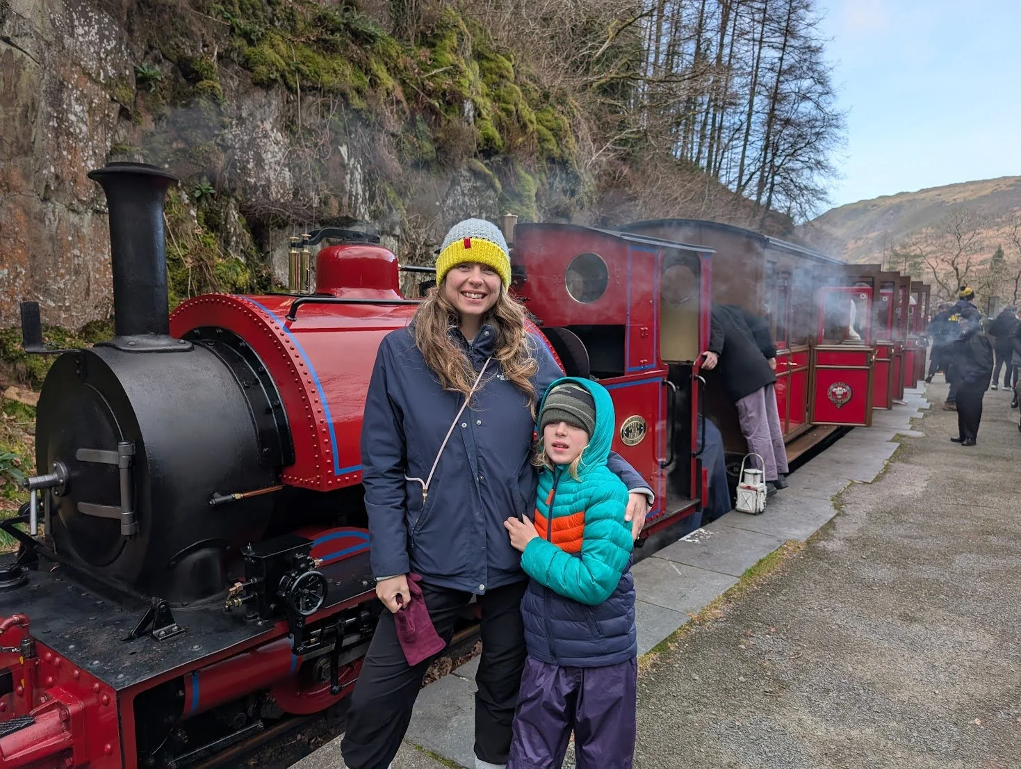
The falls sit in a wooded ravine near Tywyn and are made up of three sets of waterfalls. The Talyllyn Railway describes Dolgoch Falls as “three sets of magnificent waterfalls in a beautiful wooded ravine”, served by Dolgoch station, where passengers can get off, walk to the falls, and rejoin the train later in the day.
-
From Fro Awel on Meyrick Street, Dolgoch Falls is best reached by car. Allow roughly 30–40 minutes from Dolgellau, depending on traffic, weather and the route you take.
The usual car park is near the Dolgoch Falls B&B and Tea Rooms, just off the B4405, with a short walk into the wooded gorge from there.
You can also make the journey more memorable by using the Talyllyn Railway. Drive to Tywyn Wharf, take the steam train to Dolgoch station, walk to the falls, then rejoin the train later if the timetable allows. There are clear signs from the station towards the waterfalls and a cafe operates at Abergynolwyn Station for refreshments
-
If you are visiting with children, train lovers, or anyone who enjoys a slower holiday day, the Talyllyn historic narrow-gauge steam railway option is hard to beat.
The Talyllyn Railway runs from Tywyn to Abergynolwyn and Nant Gwernol, passing Dolgoch Falls on the way.
A good plan is to:
Drive from Fro Awel to Tywyn Wharf Station.
Take the Talyllyn Railway to Dolgoch station.
Walk from the station to Dolgoch Falls.
Explore the waterfall paths.
Return to Dolgoch station and catch a later train back.
The Quarryman’s Caban at Abergynolwyn Station provides refreshments during your journey and the trains always stop there a little longer.
There’s also the King’s Cafe at Tywyn Wharf Station if you wanted to eat after or before your journey
Important: check the Talyllyn Railway timetable before planning the day, especially outside peak season.
-
Option 1: Park at Dolgoch Falls
Park near the Dolgoch Falls Hotel / Dolgoch Falls car park on the B4405. This is the most direct option if you simply want to walk to the falls.
A small parking charge may apply. Charges can change, so bring a payment card and some coins just in case.
Option 2: Park at Tywyn Wharf Station
If you want the steam train experience, park at Tywyn Wharf Station, take the Talyllyn Railway to Dolgoch, and walk from there.
This turns the walk into more of a day out rather than just a quick stop.
-
Dolgoch Falls is a relatively short walk, but it becomes steeper and more uneven if you continue beyond the lower falls.
The main walk is around 1 mile to 1.5 miles, with an approximate duration of 45 minutes to 1 hour, depending on how far you go and how long you stop. There is a well signposted circular walk linking the three waterfalls.
A more practical way to describe it for guests:
Lower falls: short and fairly easy from the car park or station
Upper falls: steeper, with steps and uneven sections
Full circular route: allow around 1 hour, longer with children or photo stops
-
Yes, Dolgoch Falls can be a lovely family outing, particularly if you add the Talyllyn Railway.
For younger children, the lower falls are the easiest part. The higher sections are more adventurous, with steps, drops, wet rock and uneven paths, so children should be kept close.
For families, the best version of the day is often:
steam train to Dolgoch
short walk to the lower falls
continue higher only if everyone is happy
return to the station for the train back with refreshments at one of the cafes
It feels like a proper adventure without needing a long or difficult walk.
-
Dolgoch Falls is good in most seasons.
After rain, the waterfalls are often at their most impressive, but the paths can be wet and slippery. In summer, the wooded ravine gives shade and makes a pleasant change from exposed mountain routes. Autumn is especially atmospheric, with leaves, moss, water and soft woodland light.
It can be busier during school holidays and on good-weather weekends, especially when the railway is running a busy timetable. If you are driving, earlier in the day is usually easier for parking.
-
If you have time, do Dolgoch Falls with the Talyllyn Railway rather than simply driving straight to the car park. Drive to Tywyn Wharf, take the steam train to Dolgoch station, walk up to the falls, then catch a later train back.
For families, it turns a short waterfall walk into a proper holiday memory. For adults, it is a slower, scenic day out that combines woodland, water, heritage railway charm and a beautiful corner of southern Snowdonia.
Just check the railway timetable before setting off, wear shoes with grip, and allow extra time if you want to explore all three levels of the falls.
Coed y Brenin Forest Park
Coed y Brenin is the big forest adventure option near Dolgellau. It is best known for mountain biking, but it is much more than a bike park: there are walking trails, running trails, gravel routes, children’s play areas, accessible routes, picnic spots, old mine workings, rivers, waterfalls and miles of forest to explore.
It is a strong choice for mixed groups because everyone can do something different. One person can ride a mountain bike trail, someone else can take the children to the play area, and others can choose a shorter forest walk or an easier gravel route. Visit Wales describes Coed y Brenin as Britain’s first purpose-built mountain bike centre and still one of the sport’s top destinations, with trails ranging from easy family routes to technical routes for expert riders.
-
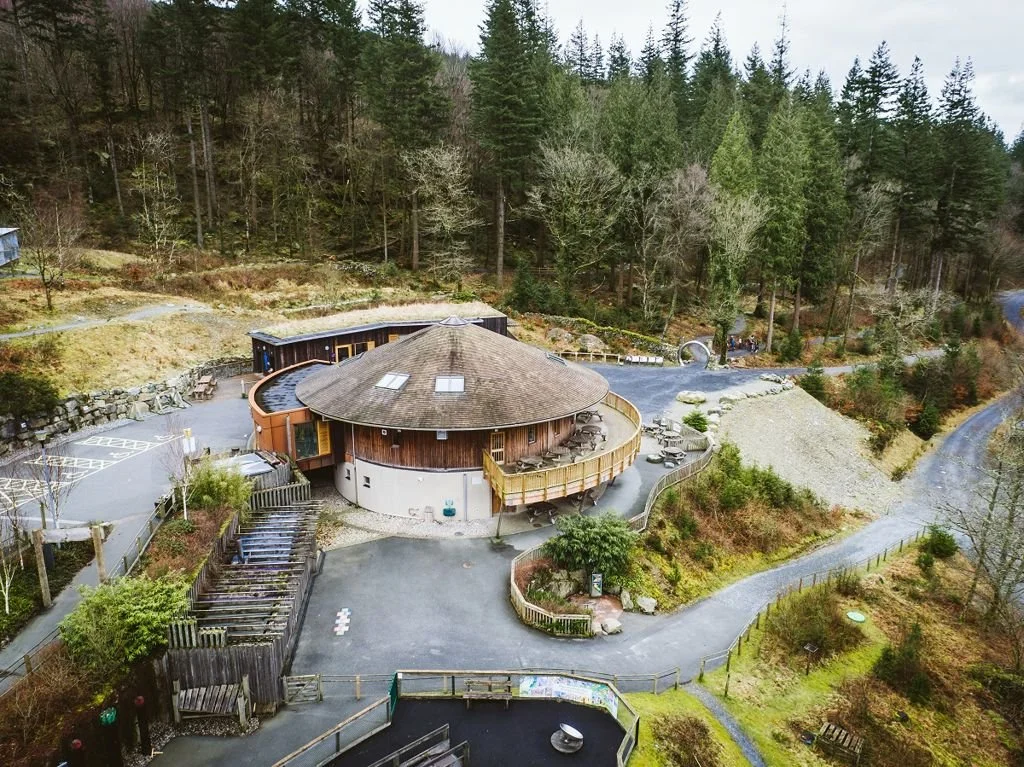
From Fro Awel on Meyrick Street, Coed y Brenin Visitor Centre is around 8 miles north of Dolgellau, just off the A470.
By car, allow roughly 15–20 minutes from the cottage, depending on traffic and weather. It is an easy drive and a good option when you want a full outdoor day without committing to a mountain walk.
The main destination for most visitors is:
Coed y Brenin Visitor Centre
Dolgellau, LL40 2HZThis is the best place to start if you want the main mountain bike trails, bike hire, the skills area, walking routes, running routes and general access to the forest.
-
For first-time visitors, park at the Coed y Brenin Visitor Centre car park. This is the main hub for the forest park and the simplest starting point for guests.
Parking charges apply every day from 6am to 11:59pm, with payment by contactless at the machine, RingGo website/app or by phone. The machine does not take cash.
Current listed parking charges are:
Up to 30 minutes drop-off/pick-up: free
Up to 1 hour: £1
Up to 2 hours: £3
Up to 4 hours: £7
All day: £12
There are also other car parks around Coed y Brenin for specific walks and quieter areas, including Glasdir, Forest Garden, Pandy, Pont Cae’n-y-coed, Pont Llam yr Ewig, Pont Ty’n-y-groes and Tyddyn Gwladys. These are useful if you already know which walk you want to do, but the Visitor Centre is the easiest starting point for most guests.
-
The forest trails remain open, but guests should know that the visitor facilities have changed.
Natural Resources Wales states that the café and shop are no longer operating, although the toilets remain open. The visitor centre is currently unstaffed and there is no first aid provision, so visitors should come prepared for their activity and know what to do in an emergency.
Beics Brenin still operates bike hire, bike shop services and trail information from Coed y Brenin, but it is worth checking opening times and booking hire bikes in advance, especially during weekends and school holidays. Beics Brenin lists bike hire, a bike shop, MTB skills training, trail information and opening hours on its website.
-
This is what Coed y Brenin is famous for. It was the first dedicated mountain bike trail centre in the UK with permanent signposted routes, and it remains one of the best-known places to ride in Wales.
The trails are waymarked and graded by technical difficulty and length, which makes it much easier to choose a ride that suits your group.
For Beginners and Families
If you are new to mountain biking or riding with children, the best place to start is the Y Ffowndri Skills Area and the easier family-friendly trails.
Y Ffowndri has short sample sections of each trail grade, from green to black, so riders can try the sort of features they may meet out on the main trails before committing to a full route.
The Minortaur trail is often the best choice for families and newer riders. Visit Wales describes it as one of the most enjoyable and accessible beginner MTB trails in the UK, suitable for families and those new to the sport.
Good for: families, beginners, children building confidence and first-time trail centre riding.
For Intermediate Riders
Intermediate riders have plenty of choice. Beics Brenin lists routes such as Cyflym Coch, Temtiwr, MBR, Tarw Du and Dragon’s Back, with different lengths and levels of technical challenge.
These are proper mountain bike trails, not simple forest tracks. Expect climbs, descents, rocks, roots, berms, technical trail features and sections where you need to be comfortable controlling the bike off-road.
Good for: regular mountain bikers, progressing riders and those wanting a proper trail centre day.
For Experienced Riders
Experienced riders often look at The Beast, Coed y Brenin’s biggest challenge. Beics Brenin lists it as 38.2 km, taking around 3–5 hours, with fast open sections, tight technical riding, flowing singletrack and rocky sections. It describes The Beast as not for the faint-hearted and a major MTB milestone for riders who are up to the challenge.
This is one for fit, confident mountain bikers with the right bike, helmet, tools, spares, water and clothing.
Good for: experienced mountain bikers, technical riding, long trail days and serious MTB holidays.
-
Guests do not need to bring their own bikes to enjoy Coed y Brenin. Beics Brenin offers bike hire from the forest, including bikes for different ages and abilities. Visit Wales says the hire fleet includes bikes for all ages and ability levels, from children’s balance and pedal bikes to modern electric mountain bikes.
This makes Coed y Brenin especially useful for families or groups where not everyone owns a suitable bike. It also gives experienced riders the option of hiring an e-MTB for a bigger day on the trails.
Book in advance where possible. Popular sizes and e-bikes can get booked up during holiday periods.
-
Coed y Brenin is also excellent for walking. If you are not cycling, you can still make a great day of it by following one of the waymarked walking routes from the Visitor Centre or from one of the quieter forest car parks.
Natural Resources Wales lists a range of walking trails through the forest from Coed y Brenin Visitor Centre, along with running trails and off-road mobility scooter trails. Visit Wales also notes that several waymarked walking trails start from the site, with some suitable for wheelchair users and off-road mobility scooters.
For guests, this is a good alternative to the exposed mountain routes. On a windy or changeable day, the forest can feel more sheltered than Cadair Idris or Precipice Walk.
Good for: woodland walks, families, mixed groups, rainy-day fresh air and gentler outdoor time.
-
If you want something a little different from the main visitor centre area, look at some of the other Coed y Brenin car parks and trails.
Glasdir is a good example. Glasdir car park is the starting point for a walk through an old copper mine, with a picnic site and barbecue by the river. It also has an audio trail explaining the history of the Glasdir copper mine.
Other named areas include:
Forest Garden — accessible trail through trees from around the world
Pandy — forest garden trails
Pont Cae’n-y-coed — challenging walk to the highest point of the forest park
Pont Llam yr Ewig — accessible trail to a viewpoint over the old copper mine
Pont Ty’n-y-groes — riverside picnic area with walking trails and gravel cycling
Tyddyn Gwladys — riverside picnic site and access to the Waterfalls and Goldmines Trail
-
Yes — Coed y Brenin is one of the best outdoor options near Dolgellau for families.
For younger children, the easier walking trails, play areas, picnic spots and Minortaur-style beginner bike routes are the main draw. For older children and teenagers, the skills area, beginner MTB routes and gravel trails can be a great step up from ordinary cycling.
The important thing is to choose the right trail. A beginner or family route is very different from a red or black mountain bike trail. If in doubt, start with the skills area or an easier route and build from there.
Family tip: if you are hiring bikes, book before you go and be realistic about everyone’s ability. A short, successful ride is much better than pushing children onto a route that is too long or too technical.
-
If you have mountain bikers in the group, Coed y Brenin is essential. It is close enough to visit more than once during a week at Fro Awel, and the range of trails means you can start gently or take on something much more serious.
For families, start with the easier trails, the skills area and a picnic rather than trying to make it too ambitious. If you just want a forest day, choose one of the walking routes or head to Glasdir for a quieter walk with old mine history and river scenery.
Bring food and water, check facilities before travelling, pay for parking, and download any maps or routes in advance. Mobile signal can be patchy in rural forest areas, and the visitor centre is currently unstaffed, so it is best to arrive prepared.